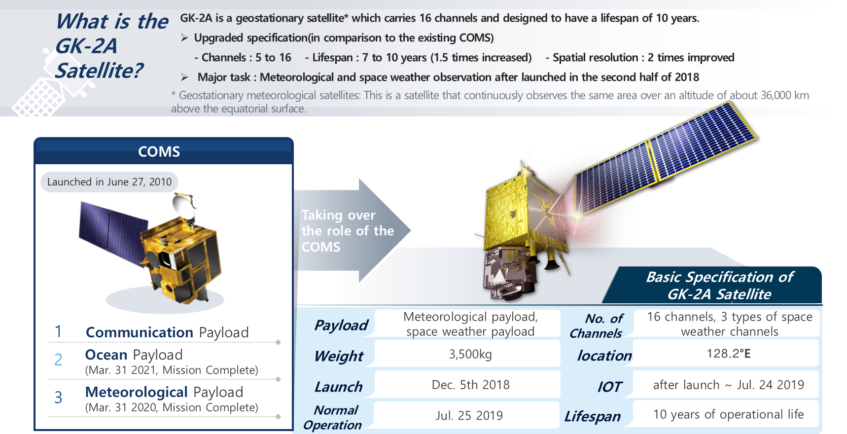
The GEO-KOMPSAT-2A (GK2A) was launched on December 5, 2018, and it allows for diverse observations with 16 channels,
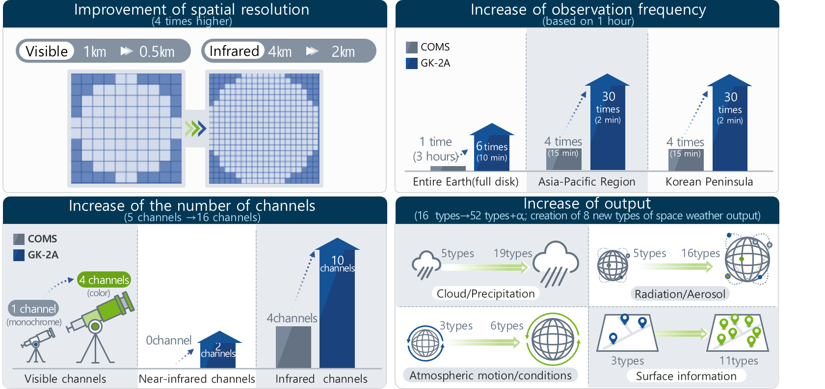
compared to the five channels of the former Communication, Ocean and Meteorological Satellite (COMS).
Based on this capability, a total of 52 meteorological products have been generated.
GK2A is capable of observing the full disk at 10-minute intervals, providing a wealth of information more quickly, making it possible to detect and prepare for severe weather occurrences.
Equipped with a high-performance weather sensor (AMI), GK2A contributes to more accurate observations,
while also providing high-resolution color images. Furthermore, the independent development of the space meteorological payload has strengthened national capabilities in space meteorological observation.
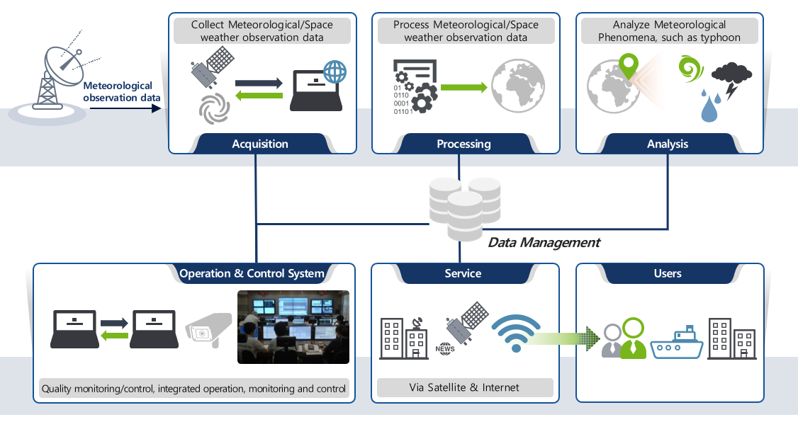
The National Meteorological Satellite Center (NMSC) has been developing ground stations since 2013 to receive, process,
and provide observation data from GK2A. Multiple backup systems ensure uninterrupted data transmission in real-time, and the established remote storage system preserves the data.
03. GK2A Meteorological Products
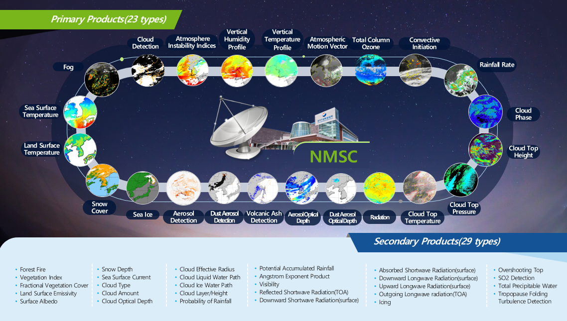
The NMSC has developed 52 meteorological products, consisting of 23 basic products and 29 supplementary products.
Its website provides more details on the specific algorithms used to generate these products.
04. Technology Development
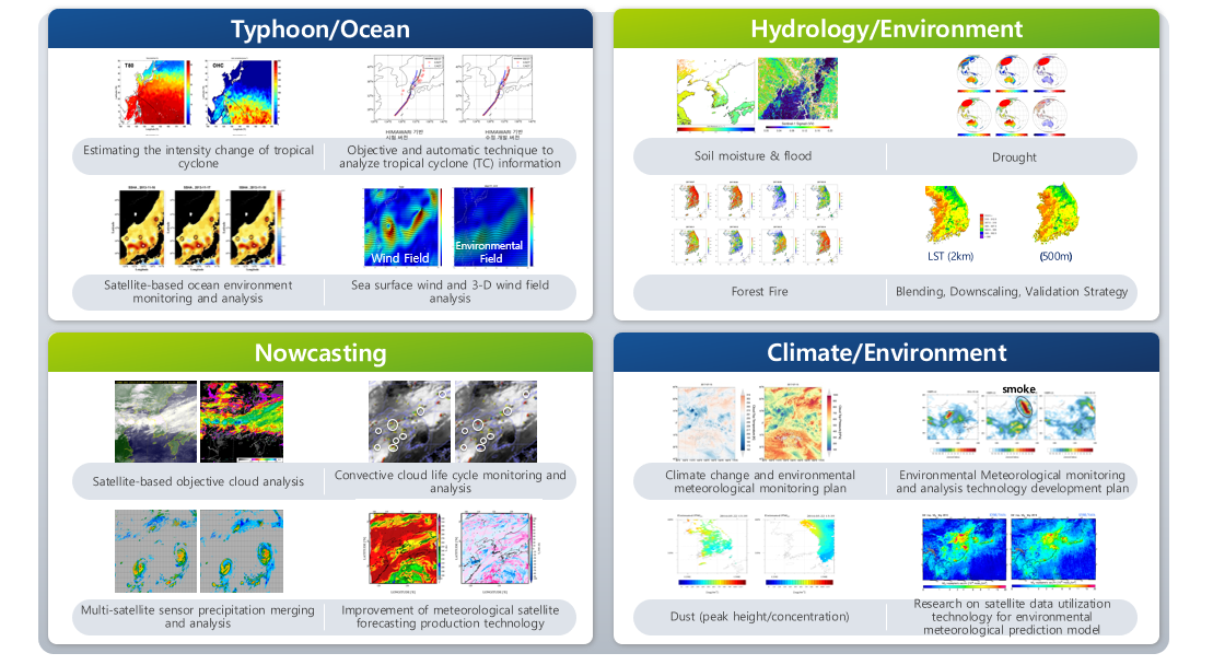
The NMSC develops and provides technologies using data received from GK2A for various applications,
including numerical modelling, typhoon and ocean observation, weather observation, and environmental monitoring.
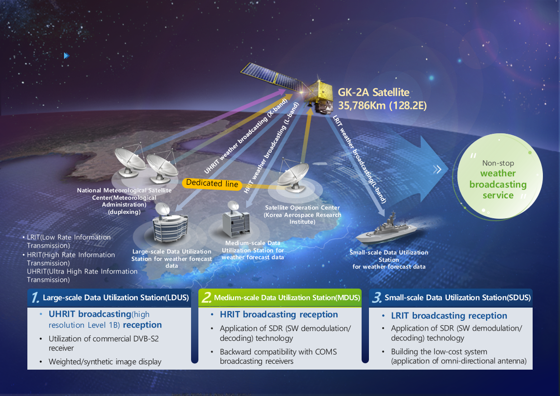
05. GK2A Ground Broadcasting Service
The NMSC has established a high performance system to process the enormous amount of data from GK2A.
Using the satellite broadcasting function on board, the system disseminates a vast amount of real-time processed data,
all channel data in their original resolution (Ultra High Rate Information Transmission, UHRIT), channel data in the same format as COMS (High Rate Information transmission, HRIT),
and offshore meteorological information (Low Rate Information Transmission, LRIT) to users in East Asia who are interested in ocean-related information.
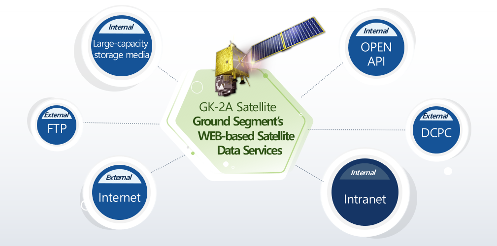
06. Web-Based Satellite Data Service
The NMSC plans to provide information in various fields to users through web pages, Open API, FTP, and DCPC.
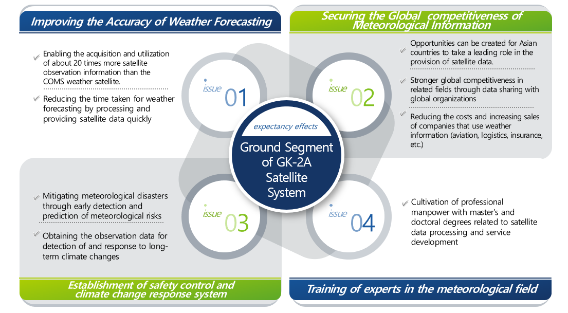
07. Expected Effects
The use of GK2A is expected to have benefits in various fields, including improving weather forecast accuracy and enhancing global competitiveness.