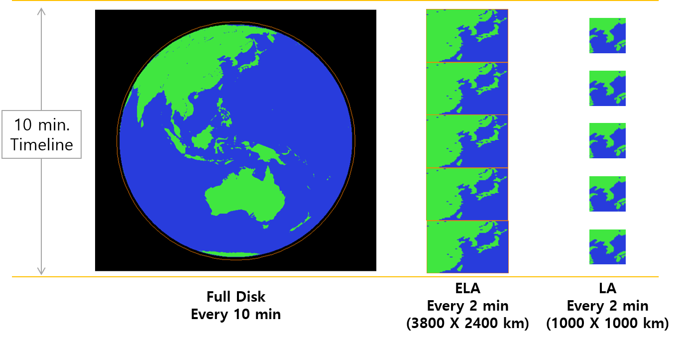
The images below display a timeline (spanning over 10 minutes in total) on both axes, indicating the types of scanning (either for calibration and navigation, or collecting images of the Earth).
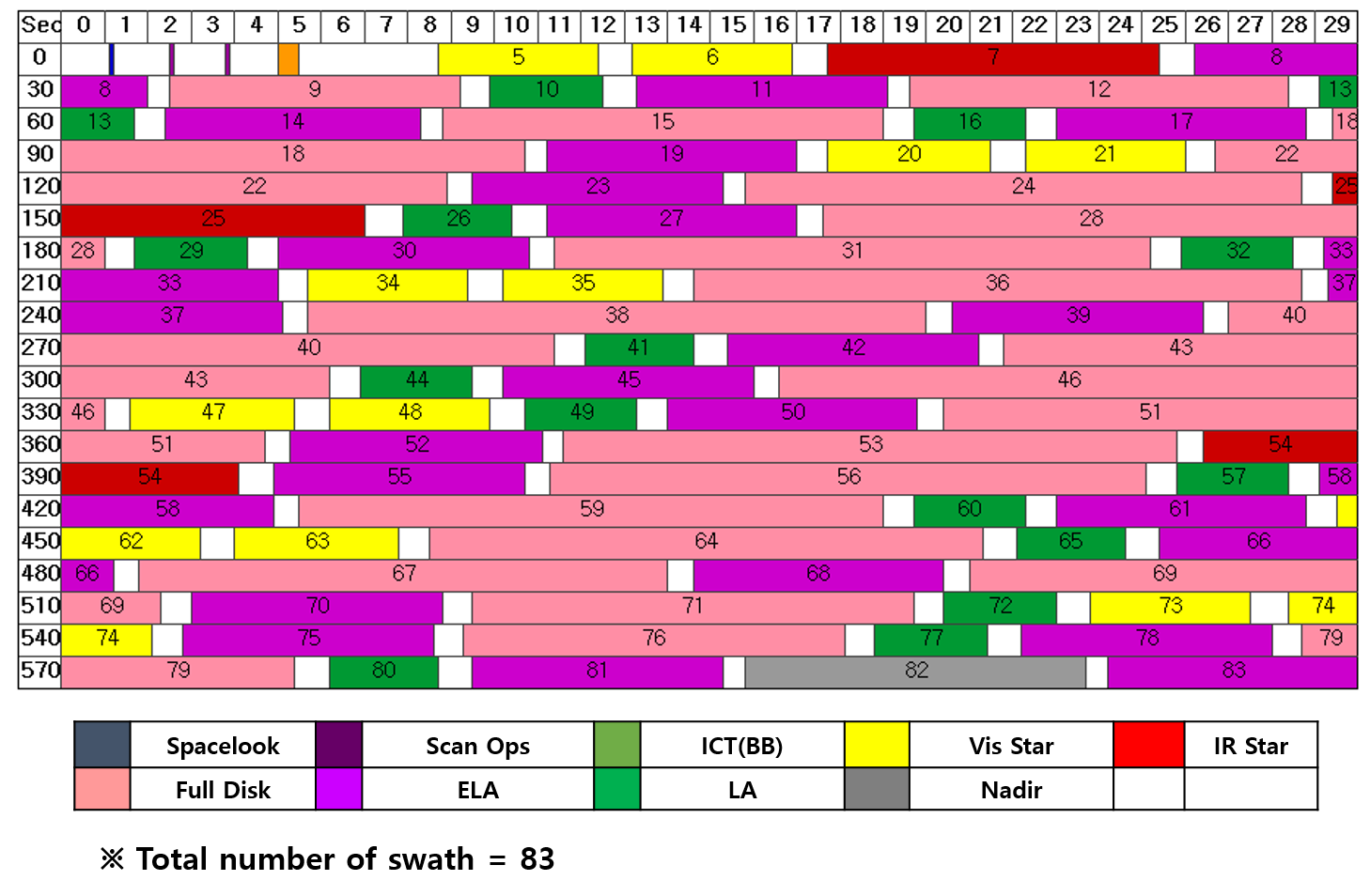
The images below display a timeline (spanning over 10 minutes in total) on both axes, indicating the types of scanning (either for calibration and navigation, or collecting images of the Earth).