Republic of Korean VLab Centre of Excellence
History
The National Meteorological Satellite Center (NMSC) was established in 2009 as a subsidiary of the Korea Meteorological Administration (KMA) to operate the Communication, Ocean and Meteorological Satellite (COMS) and provide training for research organizations.
In 2010, with the successful launch and operation of COMS, the NMSC became a member of the WMO CGMS Virtual Laboratory (VLab) Centre of Excellence (CoE) in satellite meteorology.
In 2015, the Meteorological Human Resources Development Institute (MHRDI) of KMA was also designated as a WMO Regional Training Centre (RTC) in 2015.
As the only geostationary meteorological satellite operational institution in Korea, the NMSC provides national higher education and training focused on effective uses of data and products from meteorological and environmental satellites.
The mission of the NMSC is to support prompt, accurate, and valuable weather forecasts, as well as climate and environmental services. This enables KMA staff members or other private decision-makers to use stable satellite data, reliable products, and other meteorological data to protect the safety and economy of Korea.
The NMSC also aims to contribute to a global partnership with satellite operators and space program coordination groups by sharing its COMS data and providing satellite knowledge and skills to developing countries in the RA II region.
...more ≫
Meteorological Education and Training
The NMSC primarily focuses on providing education and training to KMA staff members involved in operational meteorology and forecasts to enhance their capacities for analyzing and applying data and various products from current and next-generation satellites. This annual classroom course on “Satellite Image Analysis and Exercise” is part of a core forecasting capacity-building program and is divided into three grades based on the level of forecasters.
● Basic satellite meteorology ︾
- Objective : To understand fundamental principles of remote sensing, single channel imagery and basic products.
- Contents : Remote sensing principle, difference of geostationary and polar orbiting satellites, characteristics of single channel imagery,
identifying the type and characteristics of clouds, basic COMS products, etc.
- Participants : Forecasters with 2-3 years of experience
- Method : Lectures
● Foundational satellite meteorology ︾
- Objective : To improve satellite data utilization skills to identify and interpret synoptic and mesoscale features in the satellite images
- Contents : Upper level influences (jet stream, trough, ridge, cols, deformations, conveyer belts, etc.) on cyclogenesis, sysnoptic scale features
such as cyclones, anticyclones, lows at upper and lower levels, etc. Mesoscale features, such as comma clouds, convective
clouds and cells, dry lines, cloud street, mountain wave, turbulences, and the utilization of RGB imagery and analysis of major
meteorological phenomena, such as precipitation, fog/low stratus, Asian dusts, smoke, wintertime snowfall, etc.
- Participants : Junior forecasters with 3-6 years of experience
- Methods : Lectures and practice
● Advanced satellite meteorology ︾
- Objective : To cultivate satellite data application capacity for nowcasting
- Contents : Exercise and practice of synoptic scale feature using WV imagery, analysis and diagnosis of cyclogenesis using a blend of satellite
data, conceptual models and NWP model outputs, comparison and verification of NWP model outputs with satellite images, etc.
- Participants : Senior forecasters with more than 6 years of experience
- Methods : Lectures and practice
● Satellite analysis course on Tropical Cyclone (TC) ︾
- Objective : To understand basic TC analysis skills using satellite data
- Contents : Analysis and determination of cyclone center and intensity using Advance Dvorak Technique (ADT) and Subjective Dvorak
technique (SDT), strong wind radius with 15m/s and 25m/s using satellite data, analysis of the development and weakening of TC
using various satellite products and observation data, utilization of TC analysis system, etc.
- Participants : Typhoon forecasters
- Methods : Lectures and practice
● Satellite meteorology expert invitation course ︾
- Objective : To cultivate satellite imagery analysis capacity for forecasting
- Contents : Exercise and practice of forecast at 6 Korean airports using satellite imagery and NWP model, feature diagnosis using RGBs and other satellite products, conceptual models of cyclogenesis, comparison and verification of NWP model outputs with satellite images, etc.
- Participants : Forecasters & Satellite analysers
- Trainers : International training center
- Duration : 3 days
- Methods : Lectures and practice
Lists of Satellite meteorology expert invitation course
| Year | Period | Duration | Participants |
|---|---|---|---|
| 2016 | April 18–20 | 3 days | 42 |
| 2017 | May 29–31 | 3 days | 28 |
● Summer camp for COMS meteorological satellite ︾
- Objective : To secure future human resources by providing education about basic remote sensing theories, satellite image interpretation and
exercise
- Participants : Graduate or undergraduate students related to the field of meteorology
- Duration : 4 days
- Methods : Lectures, practice, science exhibition, recreation, exam, etc.
Lists of Satellite Meteorology Summer Camp for university students
| Year | Period | Duration | Participants | Related fields |
|---|---|---|---|---|
| 2011 | August 22–25 | 4 days | 30 | Meteorology, environment, physics, earth science, oceanography, geography, etc. |
| 2012 | June 26–29 | 4 days | 30 | |
| 2013 | June 26–28 | 4 days | 30 | |
| 2014 | June 24–27 | 4 days | 57 | |
| 2015 | August 25–28 | 4 days | 24 | |
| 2016 | June 28–July 1 | 4 days | 30 |
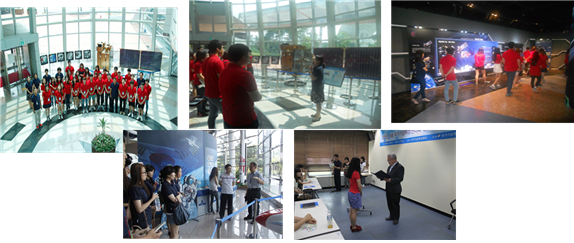
Summer camp activities about COMS meteorological satellite |
International Training Course
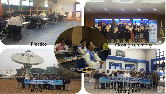
Since 2007, the NMSC, as the CoE-Korea, has been conducting an annual international training course in collaboration with the Korea International Cooperation Agency (KOICA). These courses aims to contribute to the global society by sharing satellite knowledge and skills with developing countries in the Asian-Pacific region.
The first phase of the course, from 2007 to 2015, focused on the analysis of COMS data and products. In particular, the NMSC has supported Sri Lanka and the Philippines in 2011, 2012 and 2015 respectively, by establishing a COMS data receiving and analysis system, as well as facilities for the ground station.
In line with the launch of high technology satellites such as Himawari-8, GOES-R, and FY-4, the Korean next-generation satellite, the GEO-KOMPSAT-2A satellite was launched in 2018.
To prepare for and improve capacity-building for the upgraded next-generation satellite, KMA is operating the second phase of the international training course on the “Analysis and Application of GEO-KOMPSAT-2A data” for meteorologists or government employees in the RA II and RA V regions.
...more ≫
● 1st phase (2007–2015): Analysis of COMS data ︾
- Objectives :
(1) To introduce Communication, Ocean and Meteorological Satellite (COMS) program, observation schedule and data distribution policy; and
(2) To enhance understanding of meteorological satellite products for better meteorological analysis and forecasting.
- Participants : Engineers or scientists in charge of satellite meteorology at NMHSs with at least 3 years of experience
- Language : English
- Contents : Korean weather satellite operation policy and COMS, COMS data processing, operation of the NMSC ground station system,
COMS data analysis, satellite image interpretation and supporting forecasts, usage of radar data, cultural experience and field trip,
workshop for action plans, etc.
Lists of the CoE-Korea’s international training course on satellite meteorology from 2007-2015
| Year | Duration | Participants | Region | Countries |
|---|---|---|---|---|
| 2007 | 16 days (Sept. 2–17) | 13 | RA II, RAⅤ | 13 |
| 2008 | 22 days (Sept.18–Oct. 9) | 13 | RA II, RAⅤ | 12 |
| 2009 | 22 days (Sept. 3–24) | 14 | RA II, RAⅤ | 14 |
| 2010 | 24 days (Aug.26–Sept.18) | 19 | RA II, RAⅤ | 11 |
| 2011 | 14 days (Nov.20–Dec.3) | 4 | RAII | 1 (Sri Lanka) |
| 14 days (June 10–23) | 4 | RAII | ||
| 2012 | 21 days (Sept. 2–22) | 19 | RA II, RAⅤ | 13 |
| 2013 | 31 days (June 30–July 30) | 15 | RA II, RAⅤ | 8 |
| 2015 | 7 days(Mar. 1–7) | 8 | RAII | 1 (the Philippines) |
| 14 days (May 31–June 13) | 10 | RAII | ||
| total | 119 |
● 2nd phase (2016–2018): Improvement of meteorological satellite data analysis and application competence ︾
- Objectives :
(1) To introduce Communication, Ocean and Meteorological Satellite (COMS) & GEO-KOMPSAT-2A program, observation schedule and data
distribution policy;
(2) To support better monitoring and forecasting of high impact weather, such as tropical cyclone, heavy rainfall, etc. by using data and
products from high quality multi-channel meteorological satellite;
(3) To improve analysis and application competence in the various fields such as marine, climate, environment, hydrology, etc. by using data
from GEO and LEO satellite; and
(4) To strengthen future cooperation in the meteorological satellite areas among the participating countries.
- Applicants : Scientists or working-level staff in charge of satellite meteorology or weather forecasts with at least 3 years of experience
- Language : English
- Duration : 4 weeks
- Contents : Korean meteorological satellite program, COMS data processing and products, satellite image interpretation, applications of GEO
and LEO satellite data, KMA’s GEO-KOMPSAT-2A satellite, next generation satellite data processing, RGB products and application,
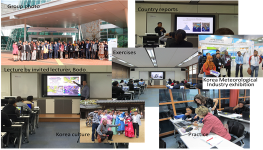
cultural experience and field trips, country reports, workshop for action plans, etc.
Lists of the CoE-Korea’s international training course on the next generation satellite since 2016
| Year | Duration | Participants | Region | Countries |
|---|---|---|---|---|
| 2016 | 24 days (Oct. 10–Nov.2) |
22 | RA II, RAⅤ | 14 (Nepal, Bangladesh, Solomon Islands, Timor-Lest, Cambodia, Laos, Sri Lanka, Vietnam, Myanmar, Mongolia, the Philippines, Indonesia, Uzbekistan, Bhutan) |
| 2017 | 24 days (Oct.30-Nov.23) |
17 | RA II, RAⅤ | 12 (Bangladesh, Cambodia, Laos, Mongolia, Myanmar, Peru, Philippine, Solomon Islands, Timor-Leste, Ukraine, Vietnam) |
| 2018 | 28 days (Oct.21-Nov.16) |
16 | RA II, RAⅤ | 11(Bangladesh, Cambodia, Laos, Mongolia, Myanmar, Philippine, Ukraine, Sri Lanka, Timor-Leste, Vietnam, Peru) |
| International training course activities in 2016 | |
|---|---|
|
|
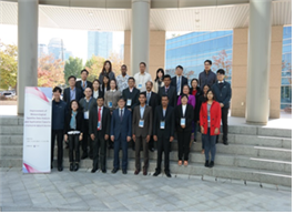
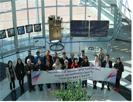
| International training course activities in 2017 | |
|
|
| International training course activities in 2018 | |
|
|
Regional Focus Group Meeting
The WMO CGMS VLab recommends that each CoE organize regular weather briefings and satellite related discussions (and also possibly discussions covering other GEO and GFCS topics) in the form of “Regional Focus Groups.”
The NMSC, as the CoE-Korea, has also commenced its participation in the monthly online RFG meeting organized by the CoE-Australia since 2015. In 2016, the NMSC held online RFG weather discussion twice jointly with the CoE-Australia under the bilateral cooperation between KMA and BoM. We are going to hold this joint RFG meeting 4 times in 2017 for RA II and RA V regions to share KMA’s knowledge, experience, methods and tools related to satellite data.
Lists of online RFG sessions for the RA II and RA V regions hosted by the CoE-Korea jointly with the CoE-Australia
| Year | Date/Time | Title of Discussions |
|---|---|---|
| 2016 | 2 Aug 02:00-03:00UTC |
- Dust detection methods using various satellite products and their limitations (Dr. Hye-Sook Park, NMSC/KMA)
[download] - Weather and Forecast Discussion (Mr. Bodo Zeschke, BMTC/BoM) |
| 2016 | 13 Dec 01:30–02:30UTC |
- Activities of the Korea Regional Training Centre and the VLab Centre of Excellence (Dr. Hye-Sook Park, NMSC/KMA)
[download]
- Trial of a short "end to end" case study as preferred by forecasters, incorporating training on the effective use of Himawari-8 data (Mr. Bodo Zeschke, BMTC/BoM) |
| 2017 | 18 April 01:30–02:30UTC |
- Improvement in the detection of snow covered areas using natural colour RGB images (Mr. Yun Bok Lee, NMSC/ KMA)
[download]
- Tropical Cyclone Debbie at landfall time; comparing various Himawari-8 satellite products and associated observations and NWP products (Mr. Bodo Zeschke, BMTC/BoM) |
| 2017 | 18 May 01:30–02:30UTC |
- Rapidly development thunderstorm detection using various satellite products (Dr. Hye Sook Park, NMSC/ KMA)
[download]
- Impact of 10 minute Himawari-8 imagery on nowcasting at the Australian Bureau of Meteorology (Mr. Bodo Zeschke, BMTC/BoM) |
| 2017 | 21 Sep 01:30-02:30UTC |
- A fog/low cloud case from Korea comparing a number of Himawari-8 and COMS products (Dr. Hye-Sook Park, NMSC/KMA)
[download]
- Analysis of a Mesoscale Convective Complex in the South China Sea (Mr. Bodo Zeschke, BMTC/BoM) |
| 2017 | 20 Dec 01:30-02:30UTC |
- Satellite-based Total Cloud Cover retrieval to support automatic cloud amount measurement (Dr. Geun-Hyeok Ryu, NMSC/KMA)
[download]
- An Australian Squall Line case study: applying some RGB products from the RGB Expert and Developers Workshop (Mr. Bodo Zeschke, BMTC/BoM) |
| 2018 | 31 July 01:30-02:30UTC |
- Characteristics of satellite products for the detection of Asian dust compared to surface observations (Dr Hyesook Park, Korea Meteorological Administration)
[download] - Developments in the True Colour RGB (Rayleigh scattering corrected and uncorrected) within the Bureau of Meteorology for fog, smoke, dust, volcanic ash case studies (Mr. Bodo Zeschke, BMTC) |
| 2018 | 30 October 01:30-02:30UTC |
- Application of Airmass RGB imagery (Ms OkHee Kim, Research Scientist, Satellite Analysis Division, NMSC, Korea Meteorological Administration)
[download] - A brief overview of AOMSUC-9 held in Jakarta and Citeko, Indonesia, showcasing some interesting manipulation of satellite data (Mr Bodo Zeschke BMTC) |
| 2018 | 18 December 01:30-02:30UTC |
- Introduction to the service plans of GEO-KOMPSAT-2A satellite (facilitator Dr. Sung-Rae Chung, Korea Meteorological Administration)
[download] - High Resolution Himawari-8 Target Area Observation case study of the recent Queensland fires (facilitator Mr. Bodo Zeschke, BMTC) |
| 2019 | 30 April 01:30-02:30UTC |
- Introducing KMA's modified Dust RGB composite for improved detection of weak dust events (facilitator Dr Hyesook Park KMA)
[download] - Examining various MODIS Aqua and Terra and Himawari-8 satellite products for monitoring the Kati Thanda-Lake Eyre floods, Central Australia, 30 March to 11 April 2019 (facilitator Mr Bodo Zeschke BMTC) |
| 2019 | 29 July 01:30-02:30UTC |
- The GEO-KOMPSAT-2A AMI Data Service Plan (facilitator Mr Hyunjong Oh National Meteorological Satellite Centre KMA)
[download] - Examining various techniques in utilising 10 minute and 2.5 minute satellite data in meteorological analysis and diagnosis (facilitator Mr Bodo Zeschke BMTC) |
| 2019 | 29 October |
- Some applications of weather monitoring using GEO-KOMPSAT-2A meteorological products(facilitator Dr Sung-Rae Chung, Korea Meteorological Administration)
- Three short case studies, including outflow from convection over Australia, 3D stereo satellite imagery over Japan and the sunglint phenomenon over Indonesia (facilitator Mr Bodo Zeschke BMTC) |
| 2020 | 13 August |
- Satellite analysis for Tropical Cyclone over KMA (facilitator Mr. Jun Park KMA)
- Designing the Indelible Moment of OGD#100; a celebration of the 100th Online Group discussion by BMKG Indonesia (facilitator Ms. Ratih Prasetya, BMKG Indonesia) |
| 2021 | 31 August |
- Application of GEO-KOMPSAT-2A Data for Severe Weather Detection, (Ms Ok Hee Kim, Research Scientist, Satellite Analysis Division, NMSC, Korea Meteorological Administration)
- Post presentation question and answer session, including a brief introduction to the 11th Asia Oceania Meteorological Satellite User Conference (AOMSUC-11) (Mr Bodo Zeschke Australian Bureau of Meteorology Training Centre) |
* The recordings of RFG meeting are on the webpage at http://www.virtuallab.bom.gov.au/archive/regional-focus-group-recordings/
...more ≫